File:2014 West Africa Ebola virus outbreak situation map.jpg
Size of this preview: 706 × 599 pixels. Other resolutions: 283 × 240 pixels | 566 × 480 pixels | 707 × 600 pixels | 905 × 768 pixels | 1,039 × 882 pixels.
Original file (1,039 × 882 pixels, file size: 160 KB, MIME type: image/jpeg)
| This is a file from the Wikimedia Commons. The description on its description page there is shown below.
|


Summary
| Description |
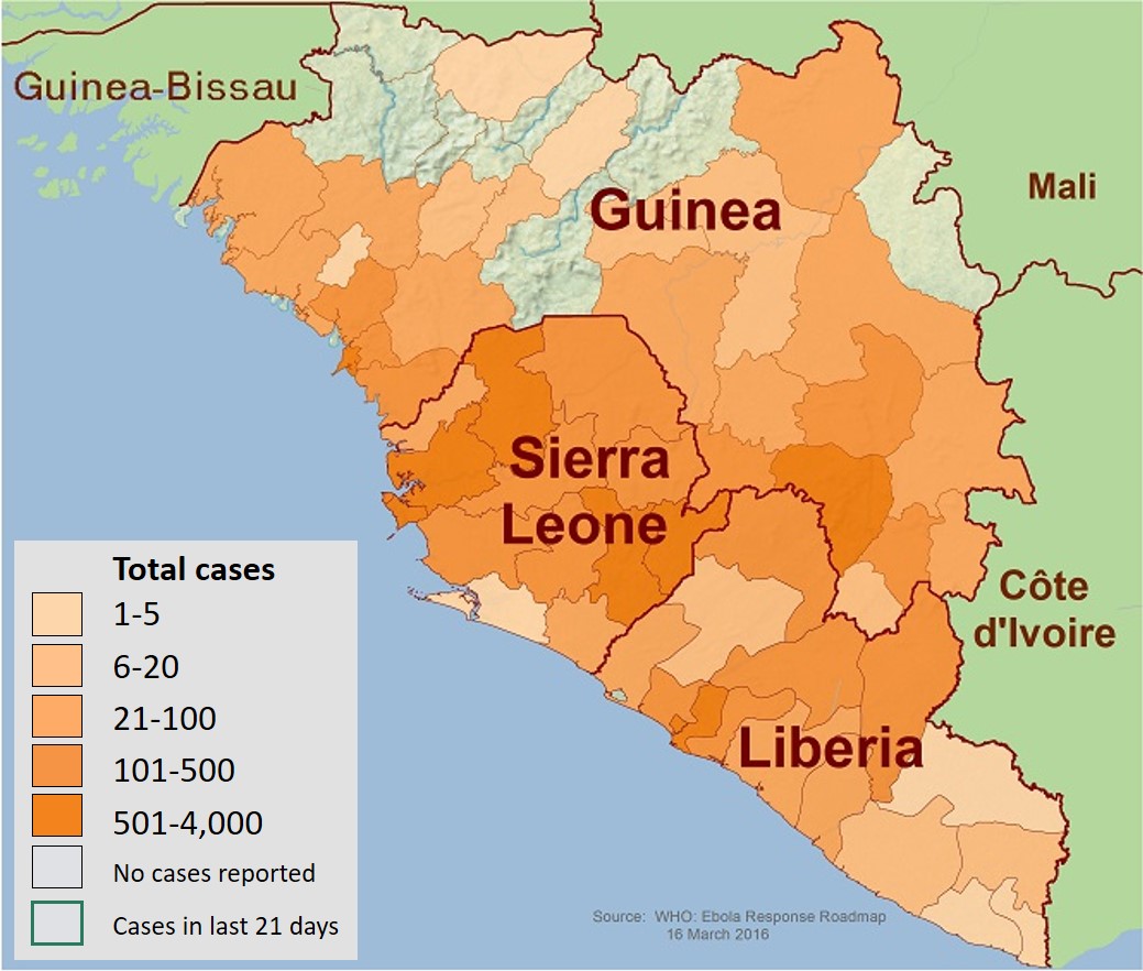
English: This is a map of the distribution of the Ebola virus epidemic in Guinea, Liberia, and Sierra Leone as of 17 December 2014. |
| Date | |
| Source | https://www.cdc.gov/vhf/ebola/resources/distribution-map-guinea-outbreak.html |
| Author | Centers for Disease Control and Prevention (CDC) |
| Other versions |
 |
Licensing
This image is a work of the Centers for Disease Control and Prevention, part of the United States Department of Health and Human Services, taken or made as part of an employee's official duties. As a work of the U.S. federal government, the image is in the public domain.
|
File history
Click on a date/time to view the file as it appeared at that time.
| Date/Time | Dimensions | User | Comment | |
|---|---|---|---|---|
| current | 22:21, 11 May 2019 | 1,039 × 882 (160 KB) | Evolution and evolvability | Updated figure legend at readable size |
File usage
The following 2 pages use this file: