File:Anguilla map.svg

Size of this PNG preview of this SVG file: 800 × 381 pixels. Other resolutions: 320 × 152 pixels | 640 × 305 pixels | 1,024 × 488 pixels | 1,280 × 610 pixels | 8,669 × 4,128 pixels.
Original file (SVG file, nominally 8,669 × 4,128 pixels, file size: 975 KB)
| This is a file from the Wikimedia Commons. The description on its description page there is shown below.
|
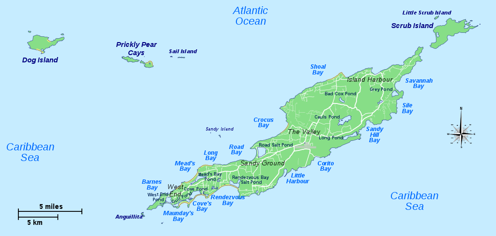
| Description | Map of Anguilla and its main islands | ||
| Date | |||
| Source | |||
| Author | Hogweard | ||
| Permission (Reusing this file) |
|
||
| Other versions | Macedonian |
File history
Click on a date/time to view the file as it appeared at that time.
| Date/Time | Dimensions | User | Comment | |
|---|---|---|---|---|
| current | 15:26, 3 May 2017 | 8,669 × 4,128 (975 KB) | Hogweard | {{Information |Description=Map of Anguilla and its main islands |Source=*{{f|Anguilla blank.svg}} *{{f|Anguilla regions map.svg}} |Date=2017-05-03 |Author={{u|Hogweard}} |Permission={{PD-self}} |other_versions= }} Category:Maps of Anguilla |
File usage
The following page uses this file: