File:Beaumont, New Zealand aerial photo 2006.jpg
Size of this preview: 800 × 562 pixels. Other resolutions: 320 × 225 pixels | 640 × 449 pixels | 1,024 × 719 pixels | 1,327 × 932 pixels.
Original file (1,327 × 932 pixels, file size: 529 KB, MIME type: image/jpeg)
| This is a file from the Wikimedia Commons. The description on its description page there is shown below.
|
Summary
| Description |
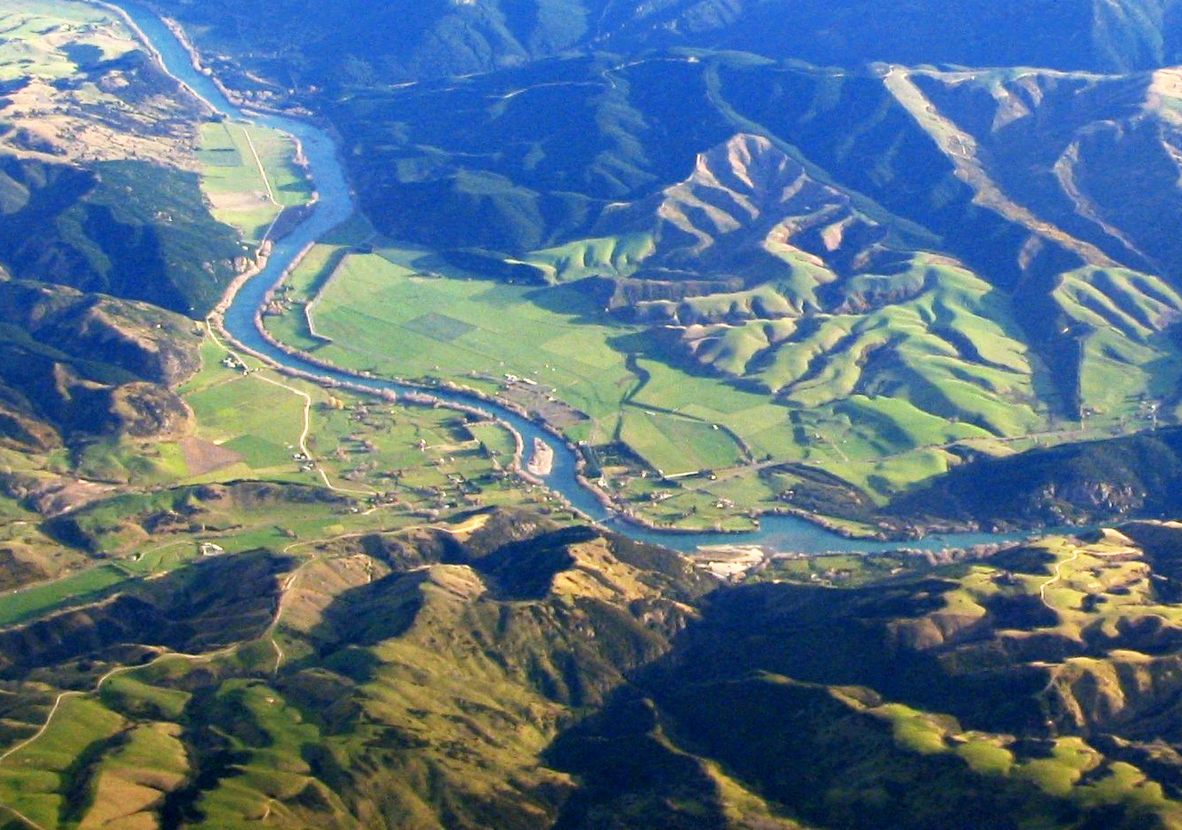
English: Aerial photo of Beaumont area in Otago, New Zealand, looking southwest, from a commerical jet flight between Dunedin and Sydney. State Highway 8 runs from left to right across the photo (only visible in the right half), and crosses the Clutha river just below centre. |
| Date | |
| Source | Own work |
| Author | Benchill |
Licensing
I, the copyright holder of this work, hereby publish it under the following licenses:
This file is licensed under the Creative Commons Attribution-Share Alike 3.0 Unported license.
- You are free:
- to share – to copy, distribute and transmit the work
- to remix – to adapt the work
- Under the following conditions:
- attribution – You must give appropriate credit, provide a link to the license, and indicate if changes were made. You may do so in any reasonable manner, but not in any way that suggests the licensor endorses you or your use.
- share alike – If you remix, transform, or build upon the material, you must distribute your contributions under the same or compatible license as the original.

|
Permission is granted to copy, distribute and/or modify this document under the terms of the GNU Free Documentation License, Version 1.2 or any later version published by the Free Software Foundation; with no Invariant Sections, no Front-Cover Texts, and no Back-Cover Texts. A copy of the license is included in the section entitled GNU Free Documentation License. |
You may select the license of your choice.
File history
Click on a date/time to view the file as it appeared at that time.
| Date/Time | Dimensions | User | Comment | |
|---|---|---|---|---|
| current | 03:16, 31 July 2009 | 1,327 × 932 (529 KB) | Benchill | {{Information |Description={{en|1=Aerial photo of Beaumont area in Otago, New Zealand, looking southwest, from a commerical jet flight between Dunedin and Sydney. State Highway 8 runs from left to right across the photo (only |
File usage
The following page uses this file: