File:CzechRepublic-geographic map-en.svg

Size of this PNG preview of this SVG file: 800 × 493 pixels. Other resolutions: 320 × 197 pixels | 640 × 394 pixels | 1,024 × 630 pixels | 1,280 × 788 pixels | 1,949 × 1,200 pixels.
Original file (SVG file, nominally 1,949 × 1,200 pixels, file size: 14.56 MB)
| This is a file from the Wikimedia Commons. The description on its description page there is shown below.
|
Summary
| Description |
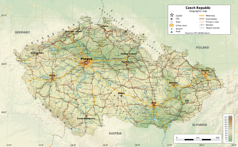
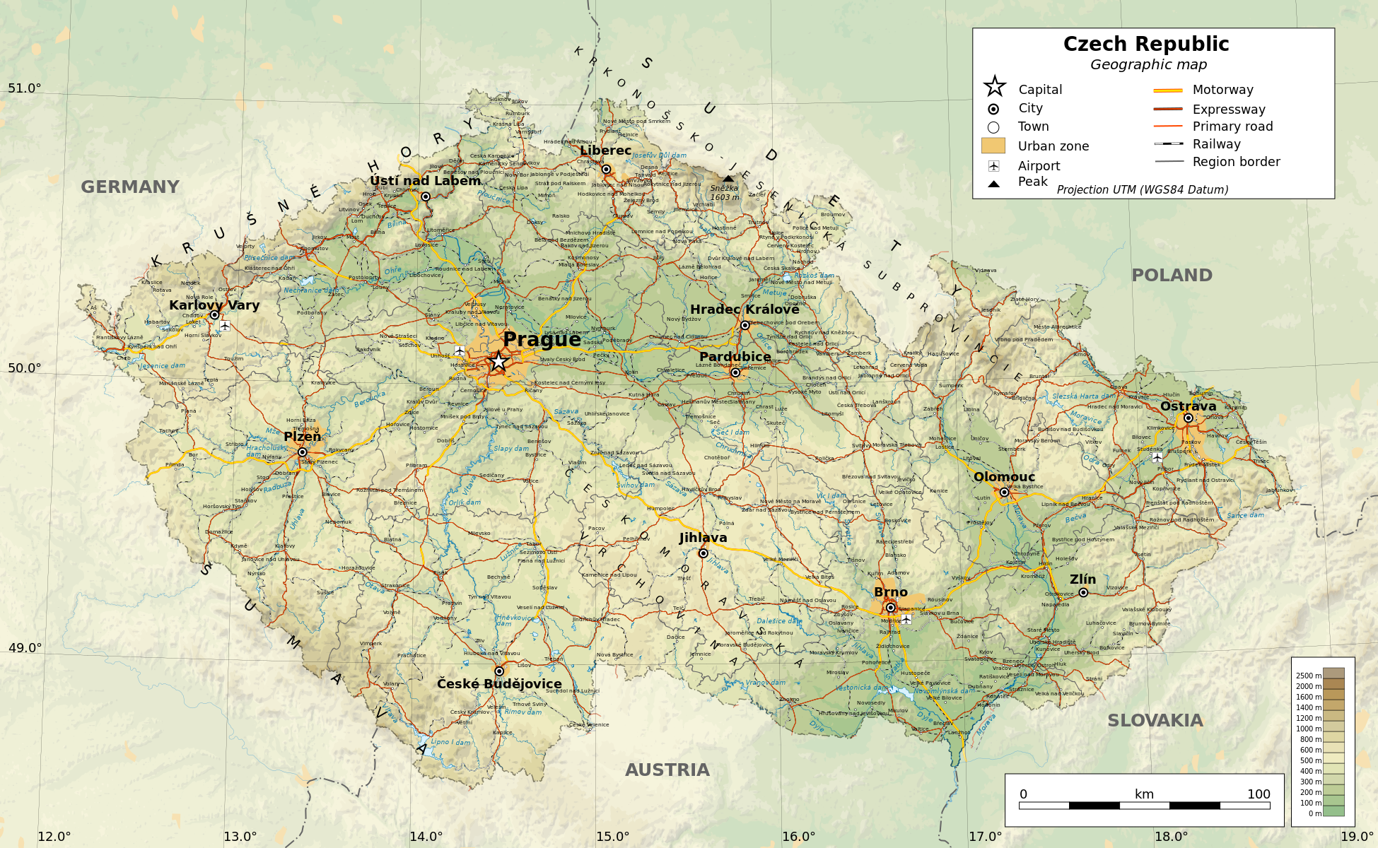
English: Geographic map of the Czech Republic. Geographic limits of the map:
Українська: Топографічна карта Чехії.
|
| Date | |
| Source |
Own work
|
| Creator | |
| Permission (Reusing this file) |
Any use of this map is subject of the license(s) stated below with the condition that you credit (Wikimedia Commons user: Ikonact) as the author . A message with a reply address would also be greatly appreciated. |
| Georeferencing | If inappropriate please set warp_status = skip to hide. |
| Other versions |
|


|

|
This SVG file contains embedded text that can be translated into your language, using any capable SVG editor, text editor or the SVG Translate tool. For more information see: About translating SVG files. |
Licensing
| This work contains information from OpenStreetMap, which is made available under the Open Database License (ODbL).
The ODbL does not require any particular license for maps produced from ODbL data. Prior to 1 August 2020, map tiles produced by the OpenStreetMap Foundation were licensed under the CC-BY-SA-2.0 license. Maps produced by other people may be subject to other licences. |
I, the copyright holder of this work, hereby publish it under the following license:
This file is licensed under the Creative Commons Attribution-Share Alike 4.0 International license.
- You are free:
- to share – to copy, distribute and transmit the work
- to remix – to adapt the work
- Under the following conditions:
- attribution – You must give appropriate credit, provide a link to the license, and indicate if changes were made. You may do so in any reasonable manner, but not in any way that suggests the licensor endorses you or your use.
- share alike – If you remix, transform, or build upon the material, you must distribute your contributions under the same or compatible license as the original.
File history
Click on a date/time to view the file as it appeared at that time.
| Date/Time | Dimensions | User | Comment | |
|---|---|---|---|---|
| current | 16:02, 20 December 2017 | 1,949 × 1,200 (14.56 MB) | Ikonact | railways cleaned a bit, town names replaced, legend completed |
File usage
The following page uses this file: