File:DIH facilities in Japan.png
Size of this preview: 573 × 600 pixels. Other resolutions: 229 × 240 pixels | 458 × 480 pixels | 734 × 768 pixels | 978 × 1,024 pixels | 1,364 × 1,428 pixels.
Original file (1,364 × 1,428 pixels, file size: 185 KB, MIME type: image/png)
| This is a file from the Wikimedia Commons. The description on its description page there is shown below.
|
Summary
| Description |
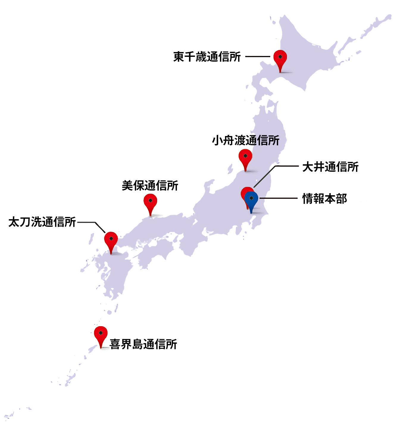
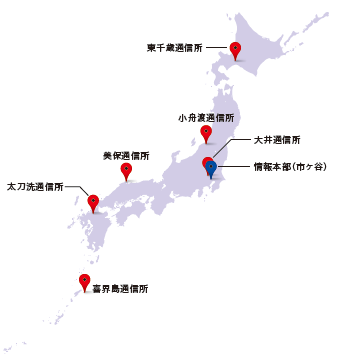
English: A map of Japan with DIH facilities (comm stations), including its headquarters.
日本語: 通信所は、我が国上空に飛来する各種電波を収集する、いわば日本の「耳」として、迅速に情報を収集・整理し、適時適切に関係機関へ電波情報を提供します。 |
| Date | |
| Source | https://www.mod.go.jp/dih/tushinjo.png courtesy of https://www.mod.go.jp/dih/organization.html |
| Author | Defense Intelligence Headquarters |
Licensing

|
This work is licensed under the Government of Japan Standard Terms of Use (Ver.2.0). The Terms of Use are compatible with the Creative Commons Attribution License 4.0 International. For the terms of use of this work, see this license page.
|
This file is licensed under the Creative Commons Attribution 4.0 International license.
- You are free:
- to share – to copy, distribute and transmit the work
- to remix – to adapt the work
- Under the following conditions:
- attribution – You must give appropriate credit, provide a link to the license, and indicate if changes were made. You may do so in any reasonable manner, but not in any way that suggests the licensor endorses you or your use.
File history
Click on a date/time to view the file as it appeared at that time.
| Date/Time | Dimensions | User | Comment | |
|---|---|---|---|---|
| current | 19:36, 24 December 2022 | 1,364 × 1,428 (185 KB) | Artanisen | Bit higher quality |
File usage
The following page uses this file: