File:Map-DB-Nassau.svg

Size of this PNG preview of this SVG file: 684 × 599 pixels. Other resolutions: 274 × 240 pixels | 548 × 480 pixels | 685 × 600 pixels | 877 × 768 pixels | 1,169 × 1,024 pixels | 1,793 × 1,571 pixels.
Original file (SVG file, nominally 1,793 × 1,571 pixels, file size: 1.67 MB)
| This is a file from the Wikimedia Commons. The description on its description page there is shown below.
|
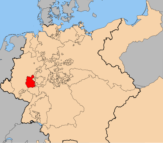
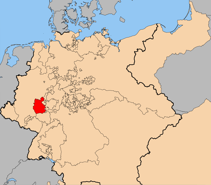
| Description | The en:Duchy of Nassau (within Germany at the time of the en:German Confederation) |
| Date | |
| Source | self-made, using the the map from Image:Map-DB-Hanover.svg. |
| Author | ZH2000 |
| Permission (Reusing this file) |
This file is licensed under the Creative Commons Attribution-Share Alike 2.5 Generic license.
|
File history
Click on a date/time to view the file as it appeared at that time.
| Date/Time | Dimensions | User | Comment | |
|---|---|---|---|---|
| current | 10:10, 29 April 2011 | 1,793 × 1,571 (1.67 MB) | ZH2010 | {{Information |Description=The en:Duchy of Nassau (within Germany at the time of the en:German Confederation) |Source=self-made, using the the map from Image:Map-DB-Hanover.svg. |Date=2011-04-29 |Author= ZH2000 |Permission={{Cc-by-sa-2.5}} |
File usage
The following page uses this file: