File:Sark-aerial.jpg
Size of this preview: 800 × 528 pixels. Other resolutions: 320 × 211 pixels | 640 × 422 pixels | 1,024 × 675 pixels | 1,280 × 844 pixels | 2,211 × 1,458 pixels.
Original file (2,211 × 1,458 pixels, file size: 1.54 MB, MIME type: image/jpeg)
This is a file from the Wikimedia Commons. The description on its description page there is shown below.
|
Summary
DescriptionSark-aerial.jpg |
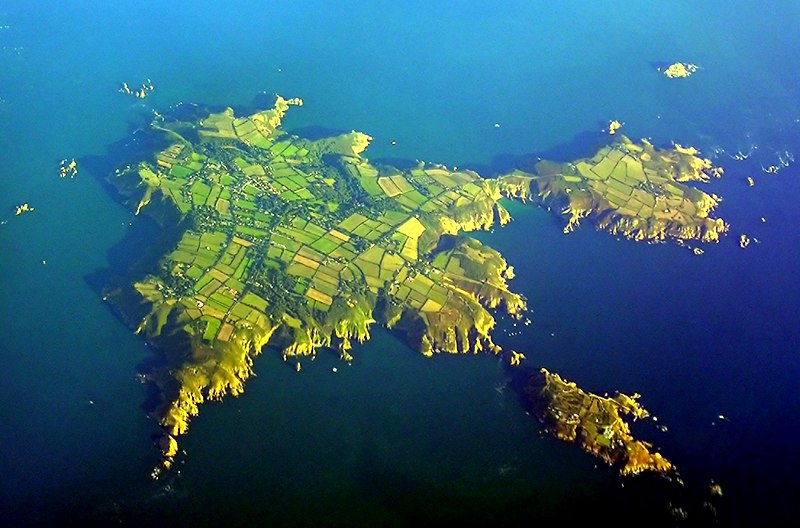
English: An aerial view of Sark. |
Date | |
Source | Sark, Channel Islands, 17 September 2005 |
Author | Phillip Capper |
Camera location | 49° 26′ 05.52″ N, 2° 22′ 08.14″ W | View this and other nearby images on: OpenStreetMap | 49.434868; -2.368927 |
---|
Licensing
This file is licensed under the Creative Commons Attribution 2.0 Generic license.
- You are free:
- to share – to copy, distribute and transmit the work
- to remix – to adapt the work
- Under the following conditions:
- attribution – You must give appropriate credit, provide a link to the license, and indicate if changes were made. You may do so in any reasonable manner, but not in any way that suggests the licensor endorses you or your use.
This image, originally posted to Flickr, was reviewed on 26 December 2006 by the administrator or reviewer Bryan, who confirmed that it was available on Flickr under the stated license on that date. |
Annotations InfoField | This image is annotated: View the annotations at Commons |
1769
135
207
122
2211
1458
L'Étacq de Sercq
287
166
155
135
2211
1458
Les Burons
431
1270
69
61
2211
1458
Bec du Nez
428
1204
75
58
2211
1458
La Grune
1664
323
69
55
2211
1458
Brenière
1954
1309
55
86
2211
1458
Givaude
1332
458
99
99
2211
1458
La Coupée
Items portrayed in this file
depicts
some value
49°26'5.525"N, 2°22'8.137"W
18 September 2005
0.00981354247776510022 second
4.40000009536743164062
21.799999237060546875 millimetre
image/jpeg
File history
Click on a date/time to view the file as it appeared at that time.
Date/Time | Dimensions | User | Comment | |
---|---|---|---|---|
current | 08:41, 3 December 2006 | 2,211 × 1,458 (1.54 MB) | L.m.k | Larger version- |
File usage
The following page uses this file:
Metadata
This file contains additional information, probably added from the digital camera or scanner used to create or digitize it.
If the file has been modified from its original state, some details may not fully reflect the modified file.
Camera manufacturer | NIKON |
---|---|
Camera model | E8800 |
Exposure time | 45,611/4,647,761 sec (0.0098135424777651) |
F Number | f/4.4000000953674 |
ISO speed rating | 50 |
Date and time of data generation | 04:31, 18 September 2005 |
Lens focal length | 21.799999237061 mm |
Orientation | Normal |
Horizontal resolution | 300 dpi |
Vertical resolution | 300 dpi |
Software used | Adobe Photoshop Elements 2.0 |
File change date and time | 15:51, 7 January 2006 |
Exposure Program | Normal program |
Exif version | 2.2 |
Date and time of digitizing | 04:31, 18 September 2005 |
APEX exposure bias | 0 |
Maximum land aperture | 3.0999999046321 APEX (f/2.93) |
Metering mode | Pattern |
Light source | Unknown |
Flash | Flash did not fire, compulsory flash suppression |
Supported Flashpix version | 1 |
Color space | sRGB |
File source | Digital still camera |
Scene type | A directly photographed image |
Custom image processing | Normal process |
Exposure mode | Auto exposure |
White balance | Auto white balance |
Digital zoom ratio | 0 |
Focal length in 35 mm film | 86 mm |
Scene capture type | Standard |
Scene control | None |
Contrast | Normal |
Saturation | Normal |
Sharpness | Normal |
Subject distance range | Unknown |
IIM version | 2 |
Retrieved from "https://wiki.kidzsearch.com/wiki/File:Sark-aerial.jpg"