File:Whiteseamap.jpg
Original file (1,478 × 1,267 pixels, file size: 370 KB, MIME type: image/jpeg)
| This is a file from the Wikimedia Commons. The description on its description page there is shown below.
|
| Description |
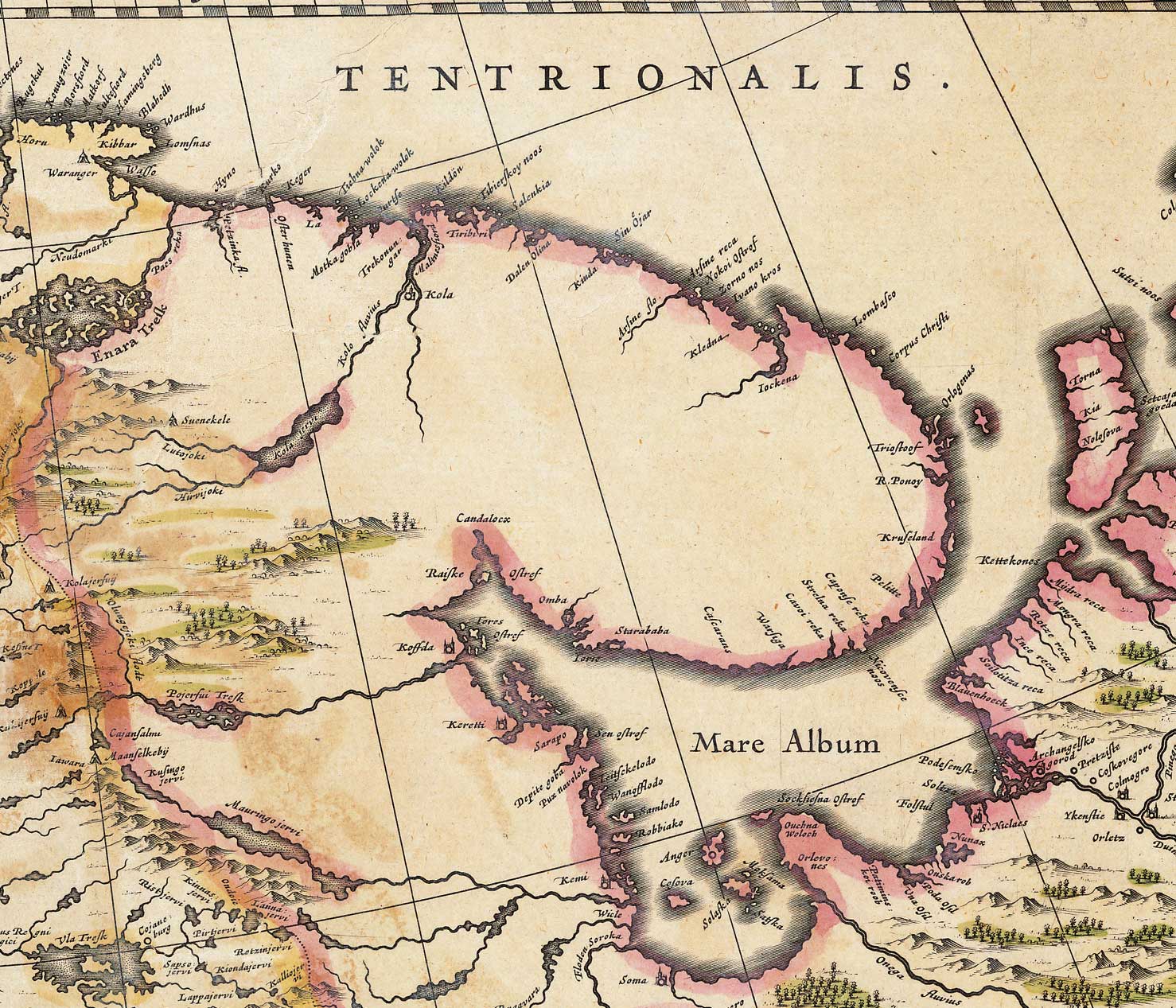
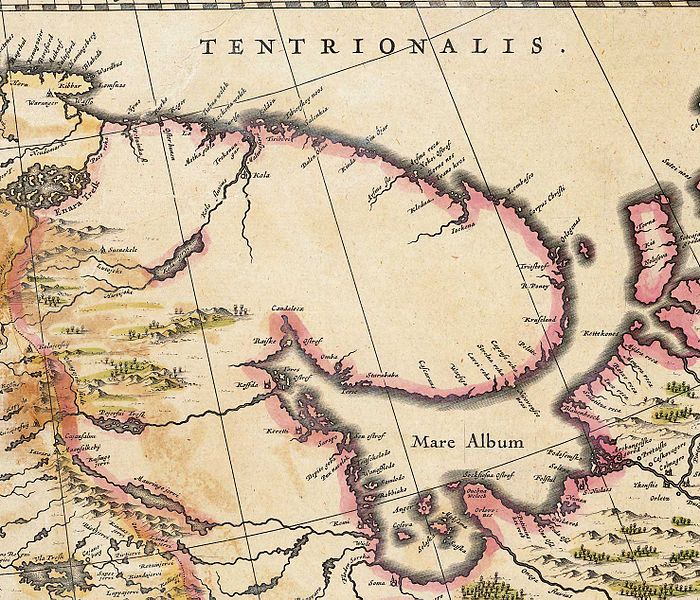
English: Map of the White Sea and adjacent regions. From the Dutch "Novus Atlas" (1635). Cartographer: Willem Janszoon Blaeu. |
|||||||||||
| Source | http://biarmia.narod.ru/17.html Transferred from en.wikipedia to Commons by Hardscarf using CommonsHelper. | |||||||||||
| Author | ||||||||||||
| Permission (Reusing this file) |
|
|||||||||||


Original upload log
- 2007-06-19 16:59 Ghirlandajo 1478×1267× (379069 bytes) Map of the [[White Sea]] and adjacent regions. From the Dutch "Novus Atlas" (1635). Cartographer: Willem Janszoon Blaeu. {{PD-art}} Source: http://biarmia.narod.ru/17.html
File history
Click on a date/time to view the file as it appeared at that time.
| Date/Time | Dimensions | User | Comment | |
|---|---|---|---|---|
| current | 04:00, 2 December 2009 | 1,478 × 1,267 (370 KB) | File Upload Bot (Magnus Manske) | {{BotMoveToCommons|en.wikipedia|year={{subst:CURRENTYEAR}}|month={{subst:CURRENTMONTHNAME}}|day={{subst:CURRENTDAY}}}} {{Information |Description={{en|Map of the en:White Sea and adjacent regions. From the Dutch "Novus Atlas" (1635). Cartographer: |
File usage
The following page uses this file: