File:FrenchEmpire1946.png

Size of this preview: 800 × 406 pixels. Other resolutions: 320 × 162 pixels | 640 × 325 pixels | 1,024 × 520 pixels | 2,000 × 1,015 pixels.
Original file (2,000 × 1,015 pixels, file size: 570 KB, MIME type: image/png)
| This is a file from the Wikimedia Commons. The description on its description page there is shown below.
|
Summary
| Description |
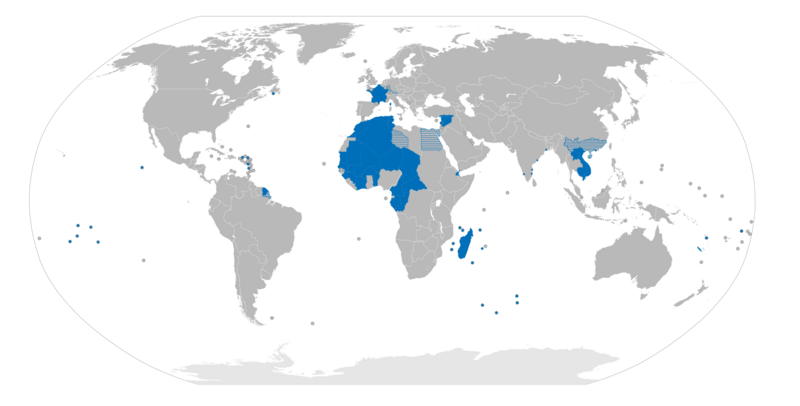
Français : Carte de l'empire français en 1946 |
| Source | Own work |
| Author | Gd21091993 |
Licensing
| I, the copyright holder of this work, release this work into the public domain. This applies worldwide. In some countries this may not be legally possible; if so: I grant anyone the right to use this work for any purpose, without any conditions, unless such conditions are required by law. |
File history
Click on a date/time to view the file as it appeared at that time.
| Date/Time | Dimensions | User | Comment | |
|---|---|---|---|---|
| current | 11:23, 2 October 2010 | 2,000 × 1,015 (570 KB) | Gd21091993 | {{Information |Description={{fr|1=Carte de l'empire français en 1946}} |Source={{own}} |Author=Gd21091993 |Date= |Permission= |other_versions= }} Category:Maps of France |
File usage
The following page uses this file: