File:Kft B-L 1789.png
Size of this preview: 631 × 600 pixels. Other resolutions: 253 × 240 pixels | 505 × 480 pixels | 787 × 748 pixels.
Original file (787 × 748 pixels, file size: 440 KB, MIME type: image/png)
| This is a file from the Wikimedia Commons. The description on its description page there is shown below.
|
| Description |
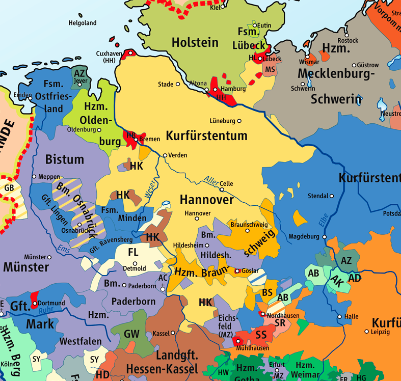
Karte des Kurfürstentums Braunschweig-Lüneburg 1789 / Map of the Electorate of Brunswick-Lüneburg 1789, Ausschnitt aus : |
||
| Date | |||
| Source | Wikipedia/Source of Information: Putzger – Historischer Weltatlas, 89. Auflage, 1965 | ||
| Author | kgberger | ||
| Permission (Reusing this file) |
GNU Free Documentation License | ||
| Other versions |
|


|
Permission is granted to copy, distribute and/or modify this document under the terms of the GNU Free Documentation License, Version 1.2 or any later version published by the Free Software Foundation; with no Invariant Sections, no Front-Cover Texts, and no Back-Cover Texts. A copy of the license is included in the section entitled GNU Free Documentation License. |
| This file is licensed under the Creative Commons Attribution-Share Alike 3.0 Unported license. | ||
| ||
| This licensing tag was added to this file as part of the GFDL licensing update. |
File history
Click on a date/time to view the file as it appeared at that time.
| Date/Time | Dimensions | User | Comment | |
|---|---|---|---|---|
| current | 15:22, 8 November 2008 | 787 × 748 (440 KB) | Papa01~commonswiki | {{Information |Description=Karte des Kurfürstentums Braunschweig-Lüneburg 1789 / Map of the Electorate of Brunswick-Lüneburg 1789 |Source=Wikipedia/Source of Information: Putzger – Historischer Weltatlas, 89. Auflage, 1965 |Date=2007-02-25 |Author=k |
File usage
The following 2 pages use this file: