File:Lesotho mountain village (5285775857).jpg

Size of this preview: 800 × 600 pixels. Other resolutions: 320 × 240 pixels | 640 × 480 pixels | 1,024 × 768 pixels | 1,280 × 960 pixels | 3,264 × 2,448 pixels.
Original file (3,264 × 2,448 pixels, file size: 2.45 MB, MIME type: image/jpeg)
| This is a file from the Wikimedia Commons. The description on its description page there is shown below.
|
.jpg)
Summary
| Description |
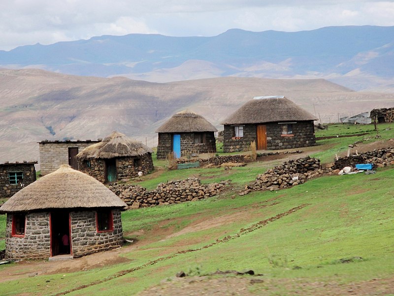
Afrikaans: Die USAID-gesteunde Horse Riding for Health-program betrek plaaslike ponieruiters en motorfietsryers om bloedtoetse, medisyne en voorrade na Lesotho se afgeleë berggesondheidsklinieke te vervoer. Hul stelsel stel mense in staat om MIV-toetsresultate gouer te ontvang, toegang tot lewensreddende middels te kry en verseker 'n ononderbroke voorraad van medikasie. Met dank: Reverie Zurba/USAID.
English: The USAID-supported Horse Riding for Health program engages local pony riders and motorcycle riders to transport blood tests, drugs, and supplies to Lesotho’s remote mountain health clinics. The system allows people to receive HIV test results sooner, access life-saving drugs, and ensure an uninterrupted supply of medication. Credit: Reverie Zurba/USAID. |
| Date | |
| Source |
|
| Author | USAID Africa Bureau |
| Camera location | | View this and other nearby images on: OpenStreetMap |
|---|
.jpg¶ms=-29.219302_N_0029.003906_E_globe:Earth_type:camera_source:Flickr_&language=en)
Licensing
This file is a work of an employee of the Executive Office of the President of the United States, taken or made as part of that person's official duties. As a work of the U.S. federal government, it is in the public domain.
|
 |
| This image, originally posted to Flickr, was reviewed on 19 September 2012 by the administrator or reviewer File Upload Bot (Magnus Manske), who confirmed that it was available on Flickr under the stated license on that date. |
File history
Click on a date/time to view the file as it appeared at that time.
| Date/Time | Dimensions | User | Comment | |
|---|---|---|---|---|
| current | 00:30, 31 January 2022 | 3,264 × 2,448 (2.45 MB) | JMK | adjust light and contrast, add some saturation |
File usage
The following 2 pages use this file:
.jpg)